Nokia has brought forward the latest version of Ovi Maps, which can be synchronized and shared between the mobile and the web to put in personal content based on location. Now users can utilize these vector-graphic maps from Nokia as a browser for all their map experiences.
The release of the Ovi Maps Player API, enables the Ovi Maps experience to be embedded easily into any well-suited website using JavaScript, has been recently publicized. This allows third parties, who want to add innovations in terms of context to their websites and thus encourage a higher level of sharing and partnership with their audiences, to utilize the Ovi Maps service and technology. Now travel and tourism websites or social networking sites can include Ovi Maps, as it can be personalized with the content that users possess and then synchronized onto their compatible mobile devices.
“Ovi Maps is evolving from a consumer service to a live and dynamic platform for location-based services and content shared between the mobile device and the web. By adding this richer dimension to Ovi Maps we are both creating new experiences for consumers and new opportunities for developers,” commented Michael Halbherr, vice president, Social Location services at Nokia. “The Ovi Maps Player API offers an open and easy-to-use map browser based on simple web technologies that can be embedded into any website. This is the first step toward an ecosystem where developers can access Nokia’s unique contextual assets, such as location, to create mobile applications that will redefine how we use our mobile devices.”
The newest version of Ovi Maps application on users’ device gets enhanced with additional features and services which bring in a whole new bag of possibilities. These features and services include high resolution satellite as well as terrain maps in 2D along with 3D views. It provides the facility for rotation, night view, tilting, fly-overs and fly-throughs. In addition to all this it has 3D landmarks for over 200 cities. Ovi Maps also provide point of interest information made available by Lonely Planet, Wcities and Michelin, plus a weather service that offers forecasts throughout the day for 5 days. Along with all the above features there’s also ‘Walk’ packed in, which is a pedestrian navigation system that has routing best made for walkers. With this system, users are provided with better orientation wherever they are. Or users can try Drive, a full blown car navigation feature, which possesses improved safety and real-time traffic information that covers many countries.
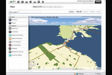
Ovi Maps is also on the world wide web, so users can search for addresses and point of interests, save places found into the Favorites section and in addition to that, arrange them in Collections. Users can check the status of the weather and plan routes for either walking or driving beforehand and even save them. All these places, collections and routes can also be synchronized over-the-air between Ovi Maps on users’ compatible mobile devices and Ovi Maps on the web.