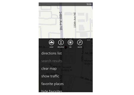
Following close on the heels of Bing Maps, the built-in Maps app for Windows Phone now provides improved traffic results. Basically, the traffic results will cover a broader scene including side streets, as compared to data seen in earlier versions.
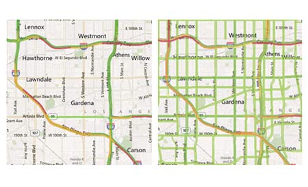
Based on residential locations, the utility will display colors for standard roads and highways. A green colored road will indicate that the traffic is less and the path is clear. Likewise, orange or yellow roads denote heavy traffic, while red streets should imply that vehicles may simply not find enough space to budge along quickly. In cases where roads are marked in black, they will clearly not be open for transit. For pathways with no data available, no colors will show up.
“Those are the basics…so what’s changed? Thanks to the hard work of our partners at Bing and Nokia, we’re now able to offer expanded traffic coverage to even more highways and secondary streets, giving you more info to help you plan your journey. Try it for yourself! In my Seattle neighborhood, I can now get traffic conditions almost straight to my doorstep. And here you can see a before-and-after example of our traffic coverage in Los Angeles,” states a post on the official Windows Phone blog.
Like we’ve mentioned above, Nokia-powered traffic conditions for small roads and side-streets are available too. In the forthcoming weeks, this new upgraded app will be rolled out to nations like Brazil, Austria, France, Belgium, Finland, Germany, Luxembourg, Russia, Turkey, the UK, Norway, and Ukraine. Some other countries set to receive it include Switzerland, Mexico, Denmark, Sweden, Netherlands, Spain, Ireland, Italy, South Africa, Poland, Greece, Portugal, India and Indonesia.
The Maps app for Windows Phone can be downloaded via the Marketplace.